



Cap de Formentor: Mallorca's Northern Cliffs
On the map, Mallorca tapers into a narrow spit of rock that plunges into the sea, facing Menorca. This is Cap de Formentor, the island's northernmost point, and anyone who visits soon understands why locals also call it the "meeting point of the winds". From Port d'Andratx it sits at the opposite end of Mallorca, but it's the kind of excursion that deserves a full day: the road, the viewpoints and the cape itself are all part of the experience, not just the destination.
A Road Built for the Scenery
The Ma-2210 climbs out of Port de Pollença for around twenty kilometres of tight bends on its way to the lighthouse. It was laid out by the Mallorcan engineer Antonio Parietti in 1925, the same man who would later tackle the equally daunting Sa Calobra road. Before this road existed, the only way to reach the tip of the cape was by boat or along a mule track, and the materials for building the lighthouse had to be brought in by sea.
The Viewpoint that Sums Up Formentor
A few minutes into the climb, the Mirador Es Colomer appears, also known as Mirador de Sa Creueta: a platform perched over a cliff more than 200 metres high, looking out at the Es Colomer islet, a 300-metre stretch of rock battered by the waves. It's the most photographed image of Formentor, and it still doesn't disappoint. Anyone with time and sturdy shoes can follow a short path up to the Talaia d'Albercutx, a sixteenth-century watchtower built to spot pirate ships, which now looks out over both sides of the cape: the cliffs on one side, the Bay of Pollença on the other.
The Lighthouse at the End of the Road
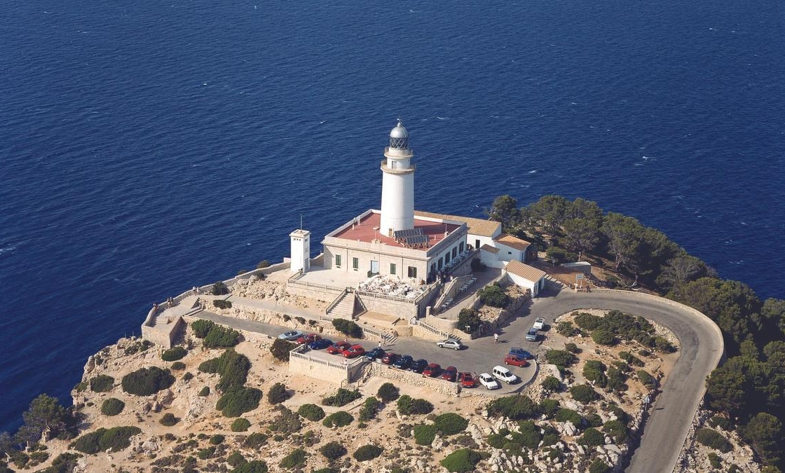
The Far de Formentor opened in 1863, on one of the most difficult sites in the Balearics to build on. It stands roughly 200 metres above the water and, on a clear day, Menorca is visible on the horizon from here. The road ends almost at the lighthouse's door, where there's a small bar and a car park that fills up quickly.
A Pine-Backed Beach and a Cove You Can Only Walk To
Halfway between the viewpoint and the lighthouse lies Platja de Formentor, an arc of fine sand and calm water sheltered by pine trees, quite unlike the rocky coves further south. A little further on, a fifteen-to-twenty-minute path leads down to Cala Figuera, smaller and quieter, a good spot for swimming without the crowds. If the plan is to complete the map of Mallorca's coves, this stretch of the north makes the perfect counterpoint to those already covered in the south and east of the island.
Planning Your Visit
Between 15 May and 18 October, from 10am to 10pm, the final stretch of road to the lighthouse is closed to private traffic to protect an area that forms part of the Serra de Tramuntana, a UNESCO World Heritage Site. During those dates and hours, the way in is bus line 334, which connects Alcúdia, Port de Pollença, Mirador del Colomer, Platja de Formentor and the lighthouse itself. Outside those dates or hours, driving up is no problem. It's worth checking the current conditions before setting off, on the official website managing the area.
Going early in the morning, or leaving it until late afternoon when the light falls sideways across the cliffs, is still the best way to enjoy Formentor without the queues of cars and cyclists that build up during the middle of the day.